

RealityCapture has long been a leading photogrammetry software tool used to automatically generate high-precision 3D models from photographs. Its strength lies in its speed and accuracy, making it a popular choice across surveying, cultural heritage preservation, and game development.
From RealityCapture to RealityScan
In 2025, RealityCapture underwent a major rebranding and emerged as RealityScan. Alongside the rebrand, RealityScan 2.0 was released with significant updates.
In this article, we take a close look at the key features introduced in RealityScan 2.0, testing them through real-world 3D data creation.
Note: The original mobile app “RealityScan” is now renamed RealityScan Mobile.
Major Updates in RealityScan 2.0
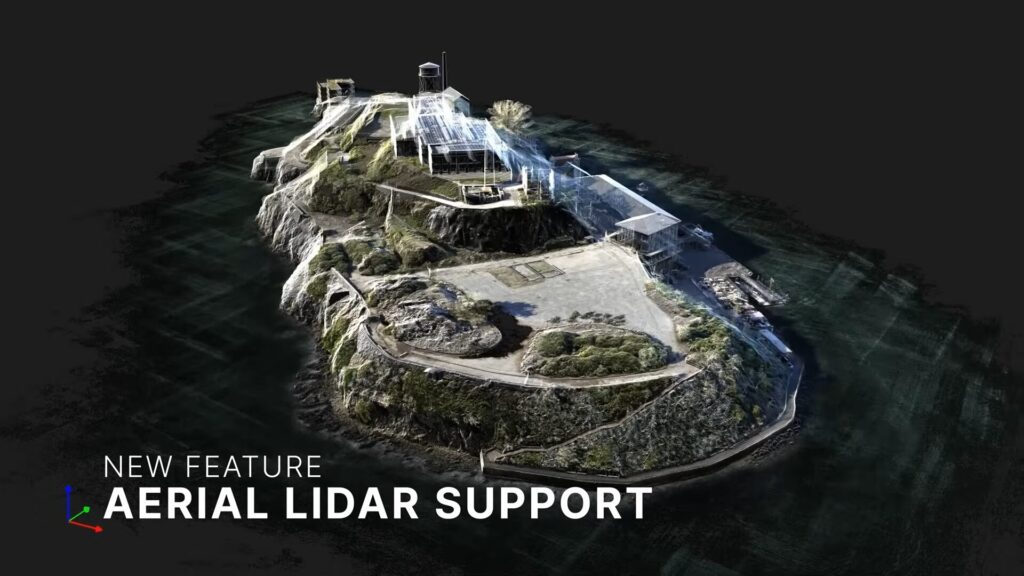
1. Drone LiDAR (Aerial LiDAR) Support
Previously, while RealityCapture could generate high-precision 3D models from multiple photos, it sometimes struggled with accuracy—especially for complex geometries or large-scale areas, resulting in distortion or incorrect scaling.
With RealityScan 2.0, this has changed. The software now officially supports importing LiDAR data captured by drone-mounted sensors. By combining imagery and LiDAR data, users can now achieve significantly improved geometry accuracy and scale fidelity.
Although RealityCapture already supported LiDAR imports, it was mostly limited to static, ground-based scanners. This meant that creating models of large areas required scanning from multiple ground positions—a labor-intensive process.
Now, with aerial LiDAR support, large-scale 3D modeling can be performed more efficiently and with greater precision.
I’ll actually make them and compare them.
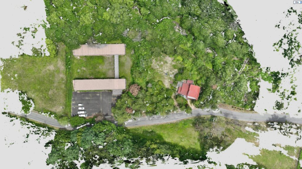
3D Model from Photos Only
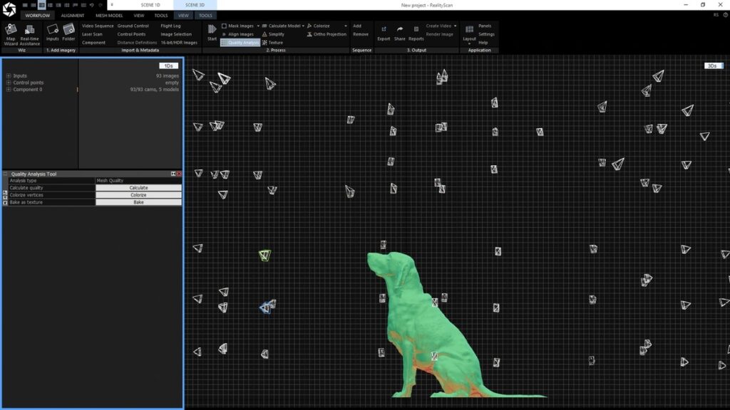
We first created a 3D model using 20 top-down drone photos.
After aligning the images, we generated a point cloud. As expected, areas like trees appeared sparse and incomplete.
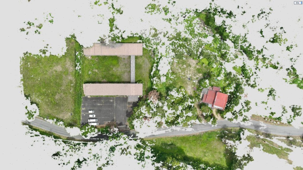
We then generated the 3D model using RealityScan’s highest quality setting. Again, tree structures were poorly reconstructed, highlighting the limitations of photo-only modeling.
3D Model with Drone LiDAR
With the new update, we tested RealityScan 2.0 using the same 20 images plus LiDAR data captured via a drone-mounted laser scanner.
Supported LiDAR formats include: .las, .laz, .e57, .xyz, .csv, and .pts.
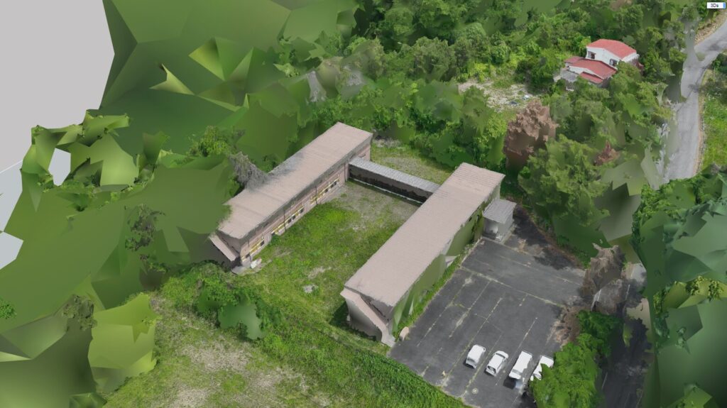
First, we created a point cloud—the density difference was immediately apparent.
Next, we generated a 3D model.
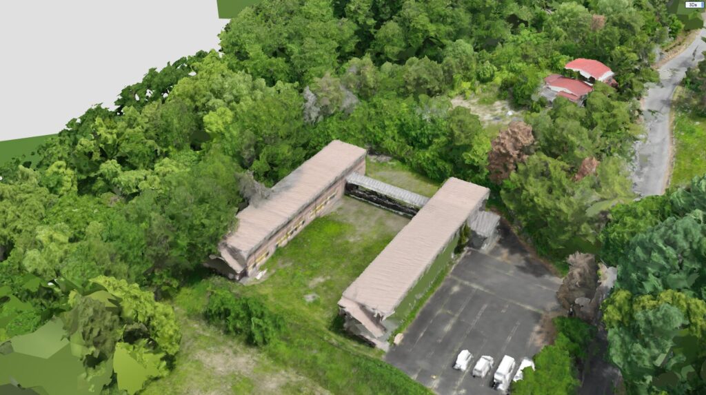
Tree structures were clearly and accurately reconstructed, a significant improvement over the photo-only version.
Because drone LiDAR sensors typically capture photos and laser data simultaneously, users can now create high-fidelity hybrid 3D models from a single flight, making this ideal for large-area surveys and cultural heritage recording.
(Unofficial) SLAM LiDAR Compatibility
Previously, RealityCapture didn’t support SLAM (Simultaneous Localization and Mapping) LiDAR data either.
With the new aerial LiDAR support, however, it’s now possible—though still unofficial—to import SLAM point cloud data by adjusting certain settings. Sources suggest official support is currently in development.
This opens up the possibility of using handheld or mobile scanners for areas inaccessible by drone, such as beneath tree cover or near structures.
In the future, combining aerial photos, drone LiDAR, and both fixed and mobile ground-based scanners could allow the creation of highly accurate 3D models across indoor and outdoor environments.
2. AI Masking Function
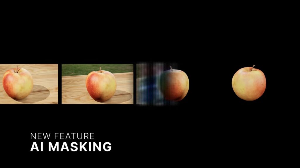
RealityScan 2.0 introduces AI-based automatic background masking—a powerful new feature that automatically removes unwanted backgrounds from photos during 3D model generation.
While background removal tools are becoming common in photo editing apps, this functionality is now integrated directly into RealityScan. It can isolate the main subject and exclude unnecessary background elements to generate cleaner, more focused 3D models.
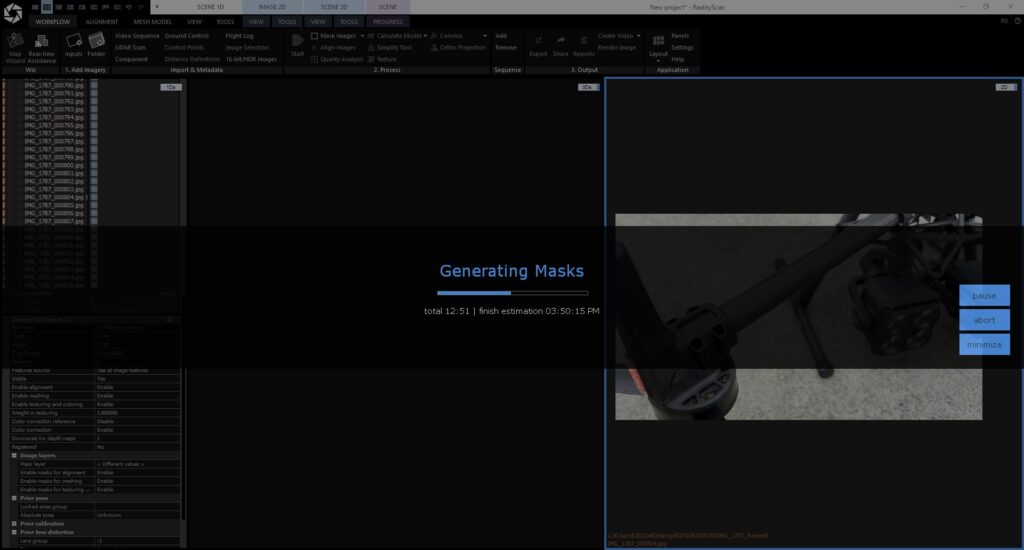
With just one click, masks are generated at a speed of about 30 images per minute.
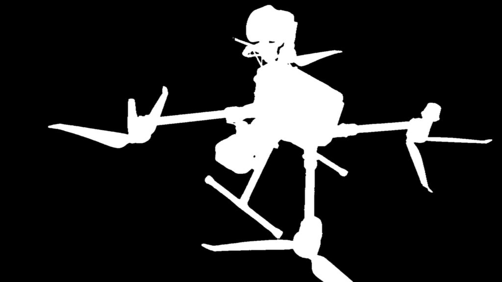
We used these AI-generated masks to create background-transparent images.
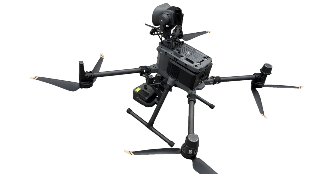
We then processed those images into a 3D Gaussian Splatting (3DGS) model.
The result was flawless.
3. Additional Enhancements
In addition to LiDAR support and AI masking, RealityScan 2.0 features improved image alignment accuracy and visual indicators for scan deficiencies. Together, these updates mark a substantial upgrade that will likely reshape photogrammetry workflows moving forward.
RealityScan is available for free for individuals, students, educational use, and non-commercial public institutions with annual revenue below $1 million.
Let ASOLAB Handle Your 3D Modeling and Photogrammetry Needs
Our drone division, Sky Fight Matsumoto, based in Matsumoto City, Nagano Prefecture, offers end-to-end drone services including surveying, infrastructure inspection, data capture, and high-resolution 3D model creation using aerial and ground-based sensors.
Why Choose ASOLAB?
- Proven Experience: Our experienced drone pilots offer tailored solutions for your unique project requirements.
- Embracing Innovation: We actively adopt cutting-edge technologies like 3D Gaussian Splatting alongside traditional mesh modeling to deliver the best results.
- Nationwide Coverage: Though based in Matsumoto, we serve clients throughout Japan.
Thinking of using drones in a new way? Curious about the latest 3D tech? Want to preserve something important in digital form?
ASOLAB is here to bring your ideas to life.
Feel free to contact us anytime.